Creating a map
Create an map with a route for ergometer space
Create a route with google maps and import it into the ergometer space maps widget
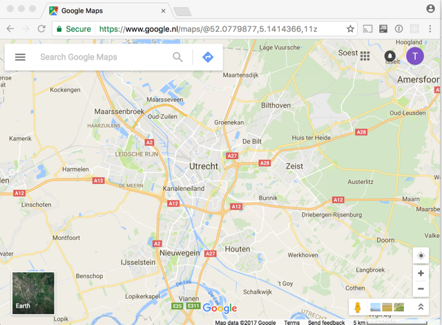
First start google maps and make sure that you are logged in into google
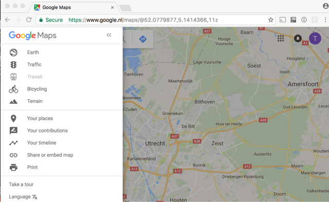
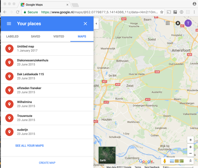
Open the menu and start your places
goto maps and choose create map
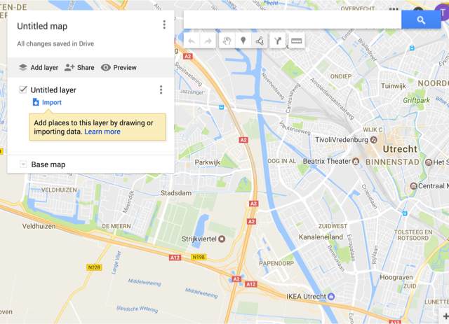
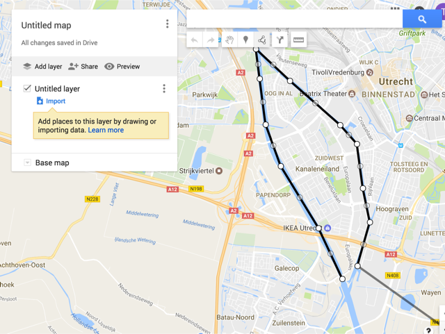
Choose the draw line tool
Draw a route. It must sinle set a set of connected lines. Just click on the points where you want the line. the application does not support closed lines. Just let the end point stop close to the start point if you want a round track.
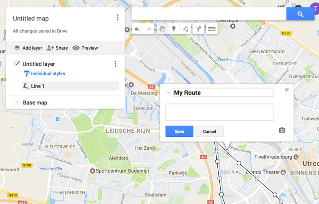
Double click on the last point . a dialog opens , give the route a name and save.
click on the style and increase the line width

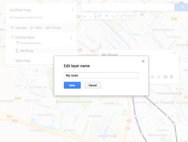
Open the menu on the the untiled layer and chose rename layer
Give the layer an name
Open the top menu and choose export to KML
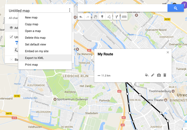
Choose the layer name which you have given Check the checkbox export to a .KML file
Then press download
Now you have a file which looks like this:
<?xml version='1.0' encoding='UTF-8'?>
<kml xmlns='http://www.opengis.net/kml/2.2'>
	<Document>
		<name>My route</name>
		<Placemark>
			<name>My Route</name>
			<styleUrl>#line-000000-4-nodesc</styleUrl>
			<LineString>
				<tessellate>1</tessellate>
				<coordinates>5.104351,52.0521738,0.0 5.0967979,52.0620955,0.0 5.0847816,52.0742308,0.0 5.0799751,52.0823543,0.0 5.0780869,52.0913202,0.0 5.0768852,52.0971206,0.0 5.0876999,52.0908983,0.0 5.1036644,52.0822489,0.0 5.1089859,52.0785565,0.0 5.1108742,52.0699047,0.0 5.1131058,52.0632564,0.0 5.1091576,52.0547072,0.0</coordinates>
			</LineString>
		</Placemark>
		<Style id='line-000000-4-nodesc-normal'>
			<LineStyle>
				<color>ff000000</color>
				<width>4</width>
			</LineStyle>
			<BalloonStyle>
				<text><![CDATA[<h3>$[name]</h3>]]></text>
			</BalloonStyle>
		</Style>
		<Style id='line-000000-4-nodesc-highlight'>
			<LineStyle>
				<color>ff000000</color>
				<width>6.0</width>
			</LineStyle>
			<BalloonStyle>
				<text><![CDATA[<h3>$[name]</h3>]]></text>
			</BalloonStyle>
		</Style>
		<StyleMap id='line-000000-4-nodesc'>
			<Pair>
				<key>normal</key>
				<styleUrl>#line-000000-4-nodesc-normal</styleUrl>
			</Pair>
			<Pair>
				<key>highlight</key>
				<styleUrl>#line-000000-4-nodesc-highlight</styleUrl>
			</Pair>
		</StyleMap>
	</Document>
</kml>
Go to the ergometer space and click on the tool buton on the map plugin
Click on load file
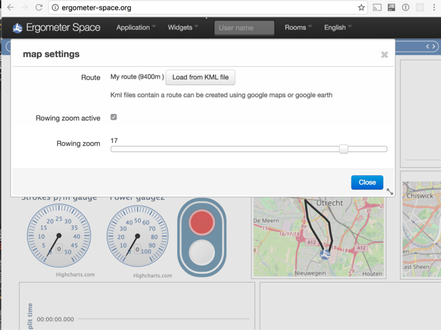
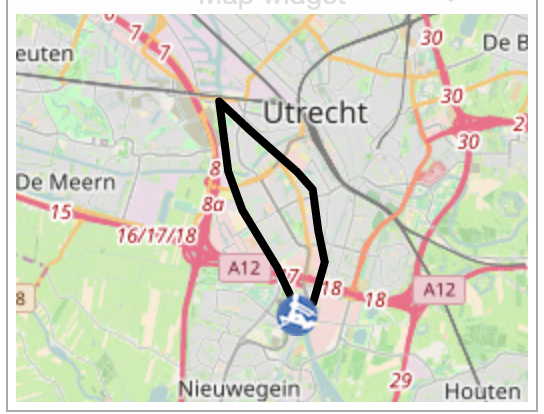
Now the route looks like this:
Sharing your creation
The shared maps are stored on github. You can fork te repository an push your own map
https://github.com/tijmenvangulik/Ergometerspace/tree/master/data/maps
place the kml file in the map directory and add a reference to the list.json
You can also send it to me using mail: tijmen@vangulik.org